Hunza
---------------------------------------------------------------------------------
The
Hunza (Burushaski and Urdu:
ہنزہ) is a mountainous valley in the Gilgit–Baltistan region of Pakistan. The Hunza is situated north/west of the Hunza River, at an elevation of around 2,500 metres (8,200 ft). The territory of Hunza is about 7,900 square kilometres (3,100 sq mi). Aliabad is the main town while Baltit is a popular tourist destination because of the spectacular scenery of the surrounding mountains like Ultar Sar, Rakaposhi, Bojahagur Duanasir II, Ghenta Peak, Hunza Peak, Passu Peak, Diran Peak and Bublimotin (Ladyfinger Peak), all 6,000 metres (19,685 ft) or higher.
History
Main article: State of Hunza
Hunza was formerly a princely state bordering Uyghurstan to the northeast and Pamir to the northwest, which survived until 1974, when it was finally dissolved by Zulfikar Ali Bhutto. The state bordered the Gilgit Agency to the south and the former princely state of Nagar to the east. The state capital was the town of Baltit (also known as Karimabad); another old settlement is Ganish Village. Hunza was an independent principality for more than 900 years. The British gained control of Hunza and the neighbouring valley of Nagar between 1889 and 1892 through a military conquest. The then Mir/Thum(Ruler) Mir Safdar Ali Khan of Hunza fled to Kashghar in China and sought what would now be called political asylum.
| The ruling family of Hunza is called Ayeshe (heavenly). The two states of Hunza and Nagar were formerly one, ruled by a branch of the Shahreis, the ruling family of Gilgit, whose seat of government was Nager. First muslim came to Hunza-Nagar Valley some 1000years (At the time of Imam Islām Shāh 30th Imam Ismaili Muslims). After the introduction of Islam to Gilgit, married a daughter of Trakhan of Gilgit, who bore him twin sons, named Moghlot and Girkis. From the former the present ruling family of Nager is descended. The twins are said to have shown hostility to one another from birth. Thereupon their father, unable to settle the question of succession, divided his state between them, giving to Girkis the north/west, and to Moghlot the south/east bank of the river.[2]
first muslim Mr Thum |
|
Mr Thum
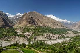
Hunza Valley near Chalt and the west face of
Rakaposhi
The traditional name for
the ruler or Prince in Hunza was Thum (also Thom or Tham),
which is also a respectful greeting used by the people of both Hunza and Nager
who belong to the clan of Boorish. The Shin use the term Yeshkun for
the Boorish
The first seat of power of the formerly Hunza State was Altit. Later it shifted to Baltit (modern-day Karimabad). Until the fall of princely state in 1974, Baltit served as political center of Hunza and hence its capital. Today, Baltit is one of the major tourist destinations in Hunza. The center of activities has however somewhat shifted to Aliabad, which is a commercial hub in the region and has most of the governmental infrastructure.
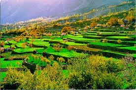
Geography
The Hunza is situated at an elevation of about 900 metres (3,000 ft). For many centuries, Hunza has provided the quickest access toSwat and Gandhara for a person travelling on foot. The route was impassable for pack animals; only human porters could get through, and then only with permission from the locals. Hunza was easily defended as the paths were often less than 0.5 metres (20 in) wide. The high mountain paths often crossed bare cliff faces on logs wedged into cracks in the cliff, with stones balanced on top. They were also constantly exposed to regular damage from weather and falling rocks. These were the much feared "hanging passageways" of the early travel accounts that terrified several famous Chinese Buddhist monks such as Xuanzang.
Hunza is divided into 3 Geographic Sub-Divisions.
Central Huza
Central Hunza comprises the parts of Aliabad tehsil of Hunza–Nagar District. The main towns, villages and valleys are:
- Murtazaab
ad: Murtazaabad is the first village of central Hunza, consisting of approximately 400 houses and a population of about 3000-4000. Murtazaabad is famous for fresh fruits, especially cherries. Gardens of Murtazaabad Ghuttoom (Thamobushie) and Farmanabad are spectacular. Furthermore there are five hot springs in Murtazaabad, namely Samate bool, Gurowel bool, Tulla Bull, Kutto Bull, and Khatkhan Bool. People of Murtazaazbad use these hot springs for laundry and bathing only, although these hot springs have enough intensity to cook beef within minutes. Sulfur rocks are found in Murtazaabad.
Aliabad
- Dourkhan
- Karimabad
- Altit
- Ahmedabad
- Burusho
- Ganish Village
- Garelt
- Hassanabad
- Haiderabad
- Salmanabad
Climate
Transport The temperature in May reaches a maximum of 27 °C (81 °F) and a minimum of 14 °C (57 °F); the October maximum is 10 °C (50 °F) and the minimum −10 °C (14 °F). Hunza's tourist season is generally from May to October, because in winter the Karakoram Highway is often blocked by the snow.
Today, the famous Karakoram Highway crosses Hunza, connecting Pakistan to China via the Khunjerab Pass, although blocked by theAttabad Lake north of Hunza. Travelling up the valley from the south, Hunza is to the left, and the former state of Nagar to the right of theHunza River. Regular bus and van services operate between Gilgit and Central Hunza (Ganish Village, Aliabad and Karimabad) and also between Gilgit and Sost Gojal. PTDC Office at Gilgit, Sost and Islamabad arranges tours and transport for visitors.NATCO (Northern Area's Transport Co) runs a daily bus from Rawalpindi to Hunza.
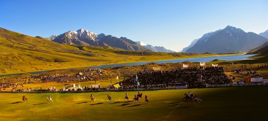
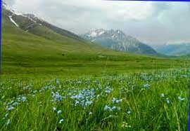
Spectacular scenery
The valley is popularly believed to be the inspiration for the mythical valley of Shangri-la in James Hilton's 1933 novel Lost Horizon.Several high peaks rise above 6,000 metres (20,000 ft) the Hunza valley. The valley provides spectacular views of some of the most beautiful and magnificent mountains of the world, includingRakaposhi 7,788 metres (25,551 ft), Ultar Sar 7,388 metres (24,239 ft), Bojahagur Duanasir II7,329 metres (24,045 ft), Ghenta Sar 7,090 metres (23,261 ft), Hunza Peak 6,270 metres (20,571 ft), Darmyani Peak 6,090 metres (19,980 ft), and Bublimating (Ladyfinger Peak) 6,000 metres (19,685 ft). A watch tower is located in heart of Ganish Village, Baltit Fort stands on top of Karimabad whereas Altit Fort lies somewhat lower down the valley on another outcrop.
Duikar Valley
Duikar is a charming hamlet above the village of Altit. One of the main attractions of Duikar is the viewpoint (2900 m), a 5 minute climb up behind the Eagle’s Nest Hotel. This gives you one of the best views during sunrise and sunset, in particular at full-moon. From Eagle’s Nest Hotel it is a 1½ hours climb up to Hosht (3600 m). From there, there are great views of the Ultar Mountains and the Hopper glacier.


 Brogpas trace their settlement from Gilgit into the fertile villages of Ladakh through a rich corpus of hymns, songs, and folklore that have been passed down through generations. The Dards and Shinas appear in many of the old Pauranic lists of peoples who lived in the region, with the former also mentioned in Ptolemy's accounts of the region. Two famous travellers, Faxian andXuanzang, traversed Gilgit according to their accounts.
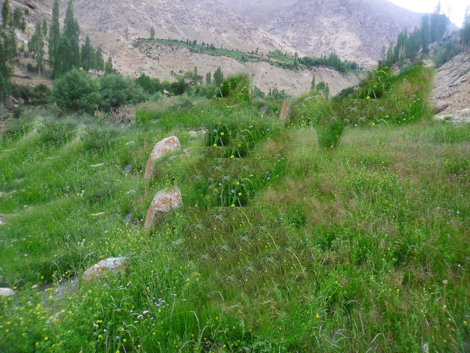.jpg) In 1877, in order to guard against the advance of Russia, the British Government, acting as the suzerain power of Kashmir, established the Gilgit Agency. The Agency was re-established under control of the British Resident in Jammu and Kashmir. It comprised the Gilgit Wazarat; the State of Hunza and Nagar; the Punial Jagir; the Governorships of Yasin, Kuh-Ghizr and Ishkoman, and Chilas.
In 1877, in order to guard against the advance of Russia, the British Government, acting as the suzerain power of Kashmir, established the Gilgit Agency. The Agency was re-established under control of the British Resident in Jammu and Kashmir. It comprised the Gilgit Wazarat; the State of Hunza and Nagar; the Punial Jagir; the Governorships of Yasin, Kuh-Ghizr and Ishkoman, and Chilas.
 In 1877, in order to guard against the advance of Russia, the British Government, acting as the suzerain power of Kashmir, established the Gilgit Agency. The Agency was re-established under control of the British Resident in Jammu and Kashmir. It comprised the Gilgit Wazarat; the State of Hunza and Nagar; the Punial Jagir; the Governorships of Yasin, Kuh-Ghizr and Ishkoman, and Chilas.


